Google creates live bushfire map
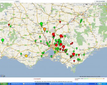
 Google developers have utilised the search giant’s mapping technology to create a live map plotting the Victorian bushfire situation.
The application takes a live feed from the Country Fire Authority to update incidents. It also shows satellite imagery.
Writing on the Google blog this afternoon, the Google engineering team led by site director Alan Noble, said: “We’re continuing to try source the most hi-res imagery and fire data available and will update the map as soon as we get it . Our thoughts are with the victims and their families and, like all Australians, we’re in awe of the efforts of everyone involved in the rescue and relief operations.”

